By automatically detecting oil slicks on the sea surface caused by maritime accidents or disasters or leaking from an offshore oil field, determine possible impact on the environment or use the data in resources development.
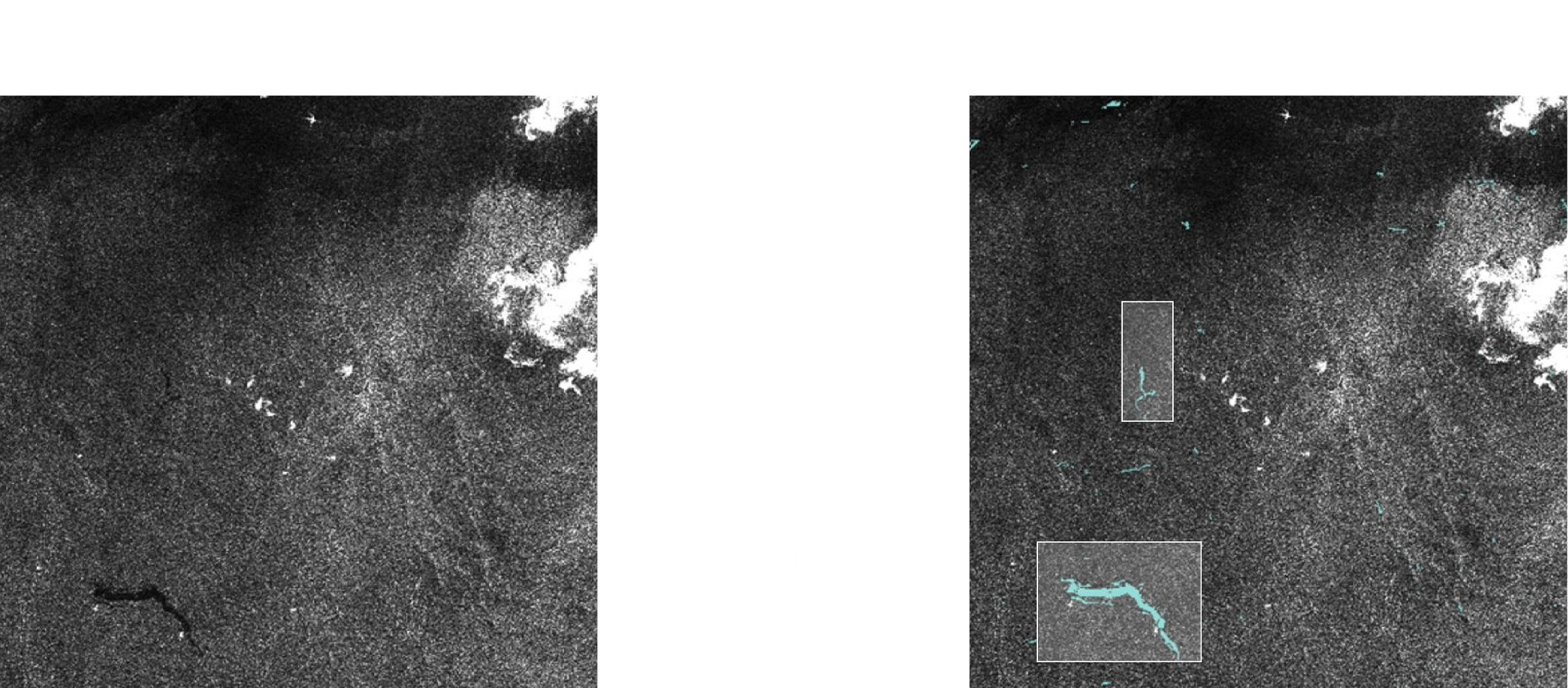
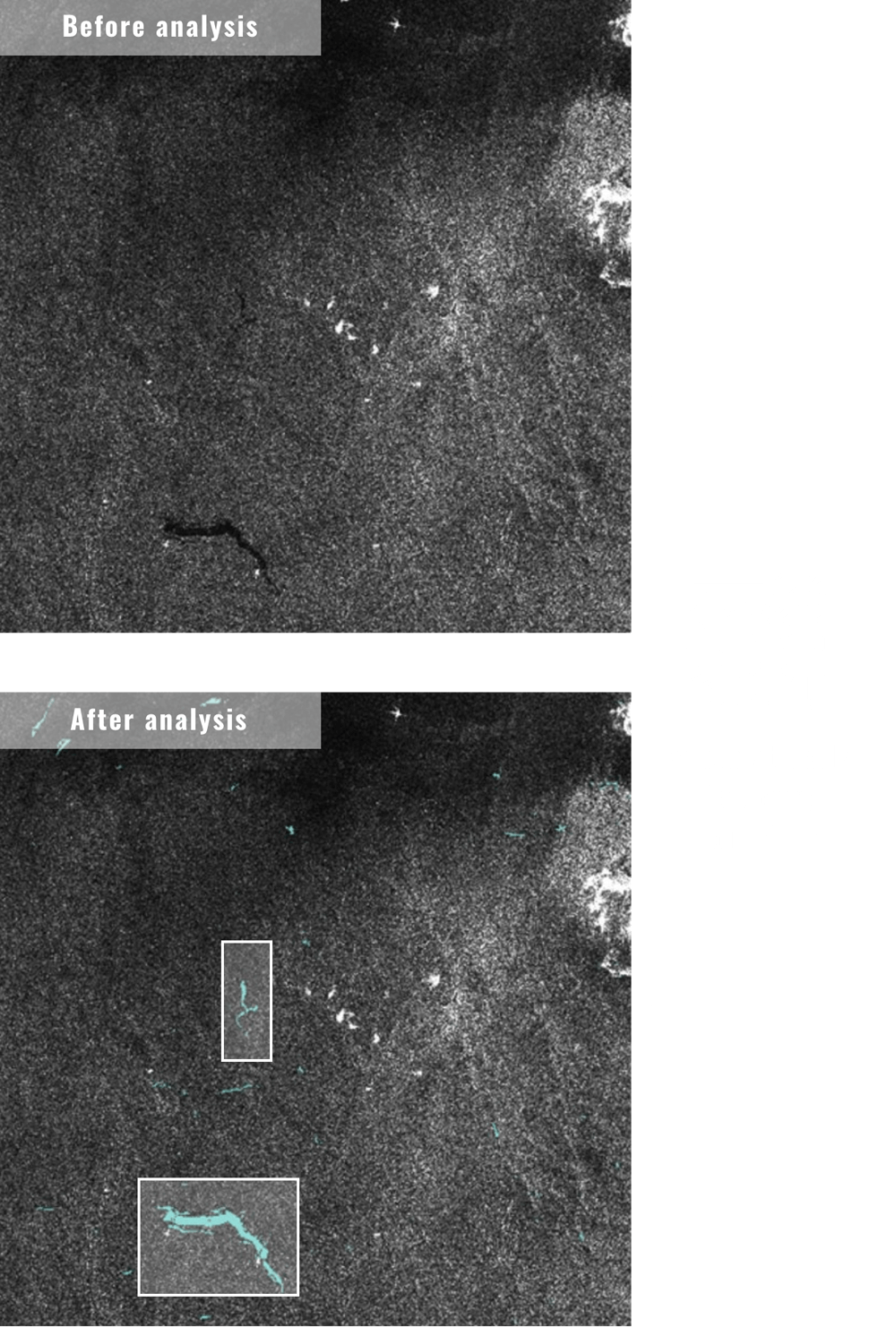
Detection of oil slick by dedicated AI algorithm
The sea surface covered by oil slick becomes smoother than the normal sea surface and appears darker on the SAR satellite image making it distinguishable.
By using a unique AI algorithm developed by Space Shift, the position, size, and number of oil slicks can be automatically analyzed from the SAR satellite image with an accuracy of more than 90%.
Upon occurrence of an oil spill incident, assess the impact on your route to change the route as necessary.

Transportation
By understanding the impact on fishing grounds and navigation routes when an incident occurs, it is possible to take action based on projected risk.

Fishery
In addition to performing environmental risk assessment upon an incident through early knowledge of damage status and identification of the spill route, use the data for resource development, i.e., to discover an offshore oil field based on how the oil slick has been generated.

National / local governments
Knowing related Technologies