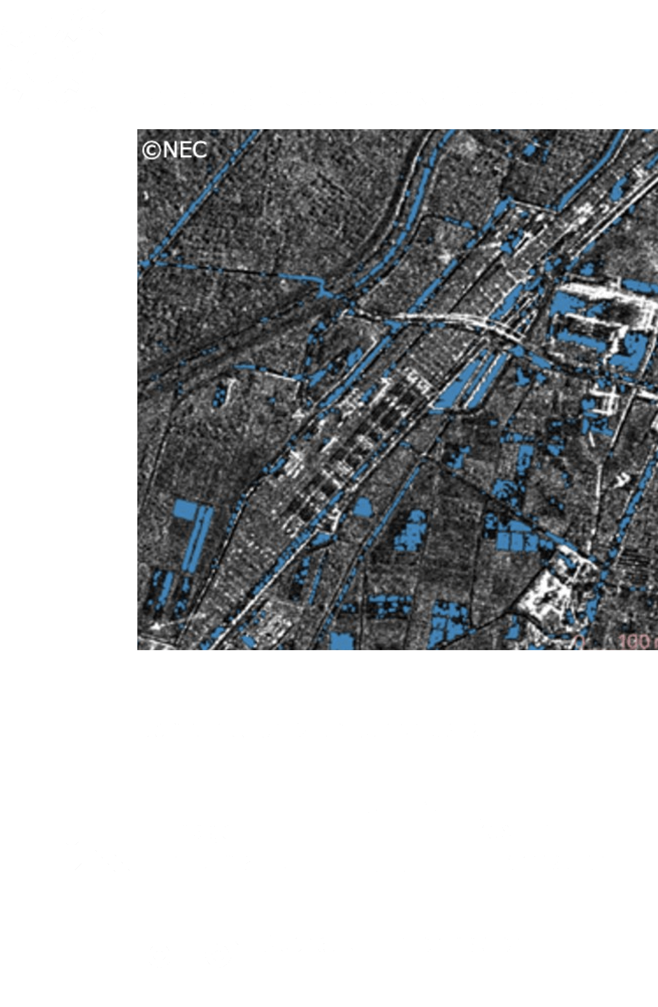
Upon flooding caused by typhoon or heavy rain, assess the damage including the range and depth of flooding.
Estimation of flood area by a dedicated AI algorithm
Using SAR satellites, as the strength of radio wave reflection varies with the target, assess the condition of the ground surface from the image data. From this characteristic, analyzing the satellite image upon a disaster can estimate the flood area and water depth.
The proprietary Space Shift AI algorithm can not only automatically analyze the information but also help realize quicker and more accurate assessment of the disaster by incorporating other information available from SNS (e.g., image and position) and vehicle traffic data.
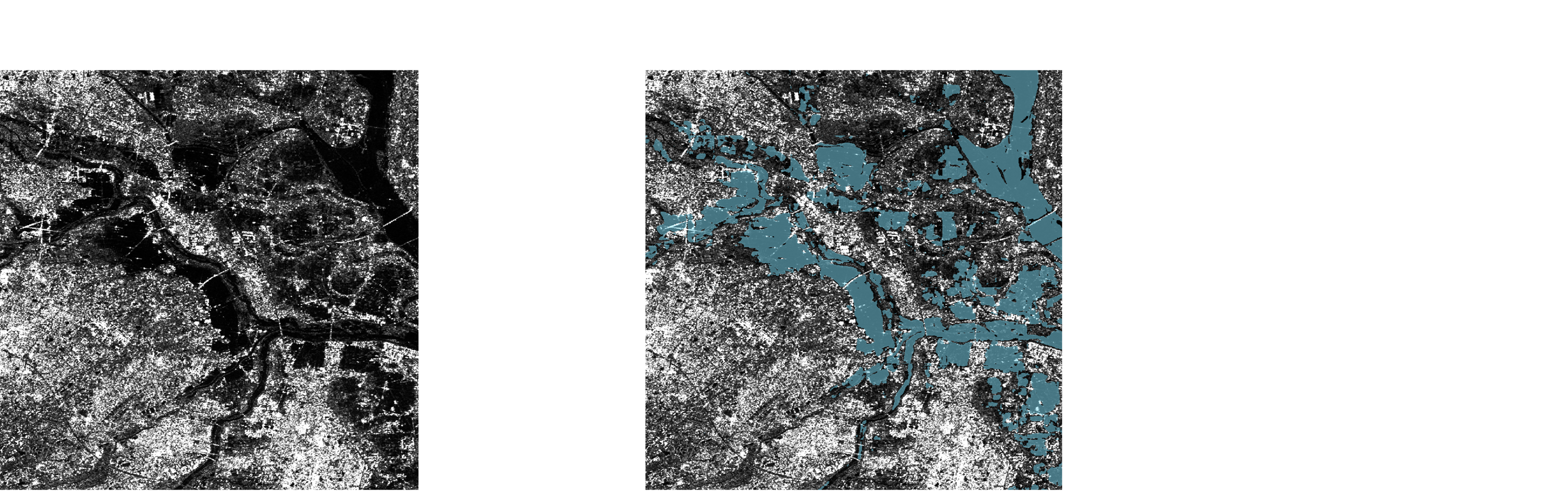
Quick assessment of the flood damage situation helps safer and quicker rescue operations as well as priority decisions in recovery planning.

National / local governments
Quickly monitoring managed infrastructure and surrounding areas upon flooding will help early assessment of the situation and planning safety assured on-site work.

Infrastructure
management
companies
By quickly grasping the flood area in a disaster, a quick and efficient insurance payment can be made.

Insurance
companies
Knowing related Technologies