[NEWS] Space Shift Participates in TRY! YAMANASHI! Demonstration Experiment Support Program Results Briefing — Improved Detection Accuracy in Mountainous and Orchard Areas Confirmed Through Demonstration with Three Municipalities in Yamanashi Prefecture
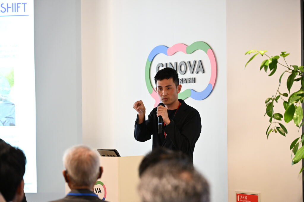
Space Shift participated in the results briefing session of the TRY! YAMANASHI! Demonstration Experiment Support Program.
Under this initiative, we conducted a demonstration experiment using our Idle Farmland Detection AI, which leverages satellite data and AI, in collaboration with three municipalities in Yamanashi Prefecture.
The demonstration confirmed improved detection accuracy for idle farmland in mountainous areas and orchard regions, where detection had previously been challenging.
◼︎What is Idle Farmland?
Idle farmland refers to agricultural land that is no longer in use. When left unmanaged, such land may gradually turn into forest or wilderness. For this reason, municipalities conduct annual inspections to monitor farmland conditions as part of farmland conservation efforts.
These inspections are typically carried out by municipal Agricultural Committees, along with agricultural committee members and promotion officers.
However, inspecting all farmland within a municipality with only several dozen personnel presents significant challenges. In addition, aging inspectors and the risk of heatstroke during summer inspections have long been recognized as major concerns.
In recent years, the risk of encounters with wildlife such as bears has also increased, highlighting the need for safer and more efficient approaches to farmland patrol activities.
◼︎What is Idle Farmland Detection AI? 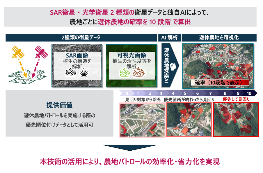
Idle Farmland Detection AI is a proprietary algorithm developed by Space Shift that specializes in detecting idle farmland.
By analyzing satellite imagery with AI, the system evaluates farmland conditions on a 10-level scale and visualizes the results on GIS platforms (including Agricultural Committees support system).
Traditionally, farmland patrols required inspectors to visually check every individual field. However, revisions to operational guidelines now allow municipalities to narrow down inspection targets in advance by utilizing satellite imagery and AI-based assessments. (*)
Satellite data offers the advantage of observing large areas at once and enables retrospective analysis using historical imagery. This makes it possible to assess idle farmland across an entire municipality and analyze historical land-use changes.
By leveraging Idle Farmland Detection AI, fields with a higher likelihood of being idle farmland can be prioritized for inspection, enabling more efficient field surveys and significantly reducing the number of locations that need to be physically inspected.
◼︎Overview of the Demonstration Project
Vegetation characteristics vary by municipality, and improving detection accuracy requires diverse training data. While the conventional model performed relatively well in detecting rice paddies, it faced challenges in identifying idle farmland in mountainous areas and orchard regions.
To address this issue, the demonstration project collected training data in Yamanashi Prefecture, a region known for its fruit production and mountainous terrain, and improved the model accordingly.
As a result, the detection accuracy of idle farmland in mountainous and orchard areas was successfully enhanced. The results of this demonstration will be published later as a white paper.
Further details will be available in the upcoming publication.
Inquiries Regarding This Article
Space Shift Inc. (Attn: Tsudatani)
E-mail: pr@spcsft.com

