[NEWS] The example of automated vessel detection using SAR imagery around the Strait of Hormuz
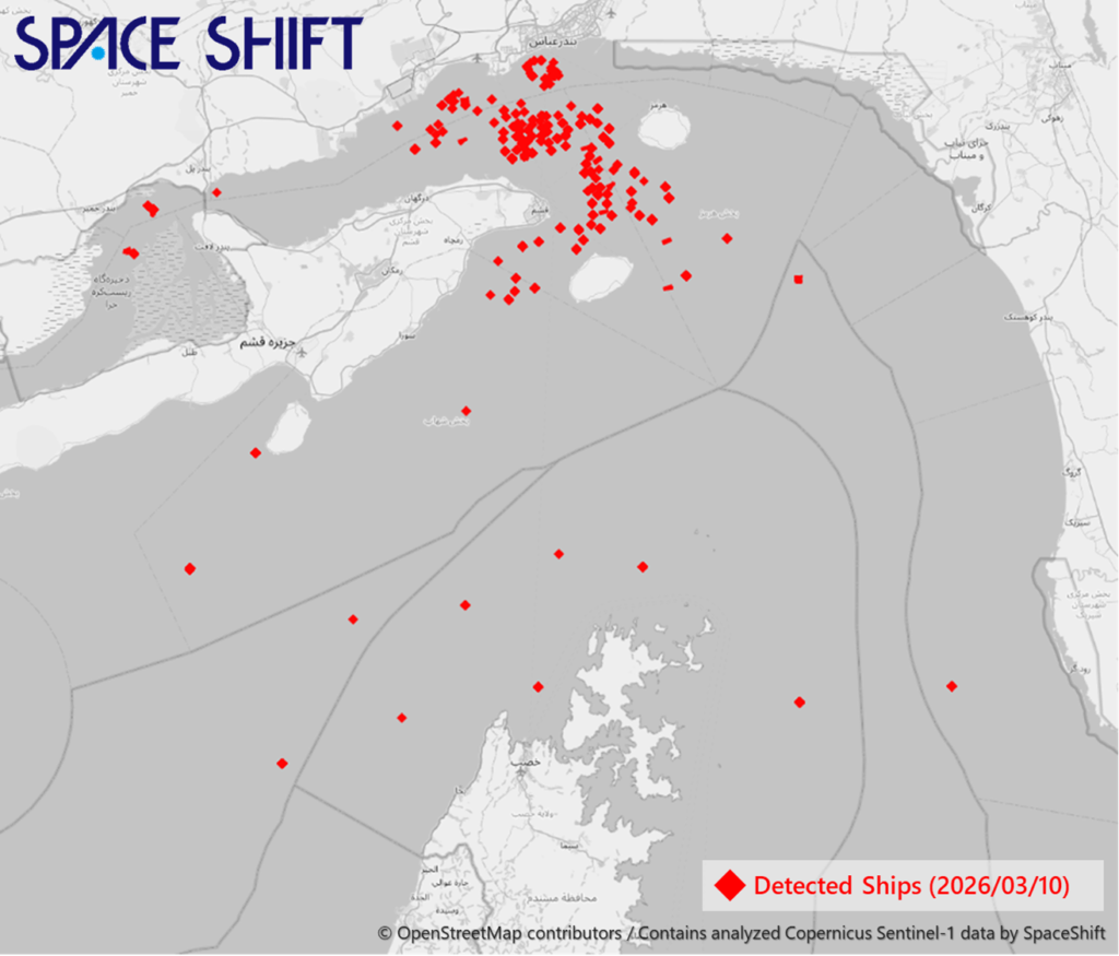
The image shows an example of vessels detected from Sentinel-1 satellite data around the Strait of Hormuz using Space Shift’s SateAIs “Ocean” (Ship Detection AI).
At present, it is difficult to obtain vessel location information in the Strait of Hormuz through AIS and other means, so satellite data plays a major role in understanding the actual situation under these conditions.
In particular, observation by SAR satellites, which can operate regardless of weather conditions or time of day, is highly important.
Space Shift provides a service that automatically detects vessels from multiple SAR satellites. Through its Web API, vessels can be detected automatically as soon as imagery becomes available, without the need to download the data first.
Space Shift aims to become an infrastructure that makes the use of satellite data accessible to everyone.
Inquiries Regarding This Article
Space Shift Inc. (Attn: Tsudatani)
E-mail: pr@spcsft.com