

[Press Release] New Official Plugin Launches to Run “SateAIs™” Analytics Directly from QGIS
– Enables seamless integration of satellite data analytics into GIS workflows directly on the map—no programming required. –
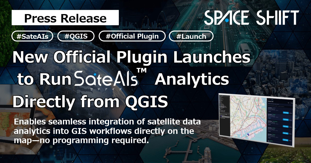
Space Shift is pleased to announce the release of “SateAIs™ API for QGIS,” an official plugin that enables users to run “SateAIs™ API” satellite analytics directly within the GIS software QGIS. Available as a free download from the official QGIS plugin repository, the plugin allows users to seamlessly handle everything from running analyses to visualizing results on the map simply by selecting a target area—eliminating the need for manual data downloading or format conversion.
Following the April 2026 beta launch of “SateAIs™ API”—a self-service platform for AI-powered satellite data analytics—and the July rollout of official SDKs (Python, JavaScript/TypeScript) and a CLI, Space Shift is expanding its reach. This new QGIS plugin empowers GIS professionals across local government, construction, mapping, and research sectors who may not have programming expertise to easily harness satellite data analytics within their everyday QGIS workflows.
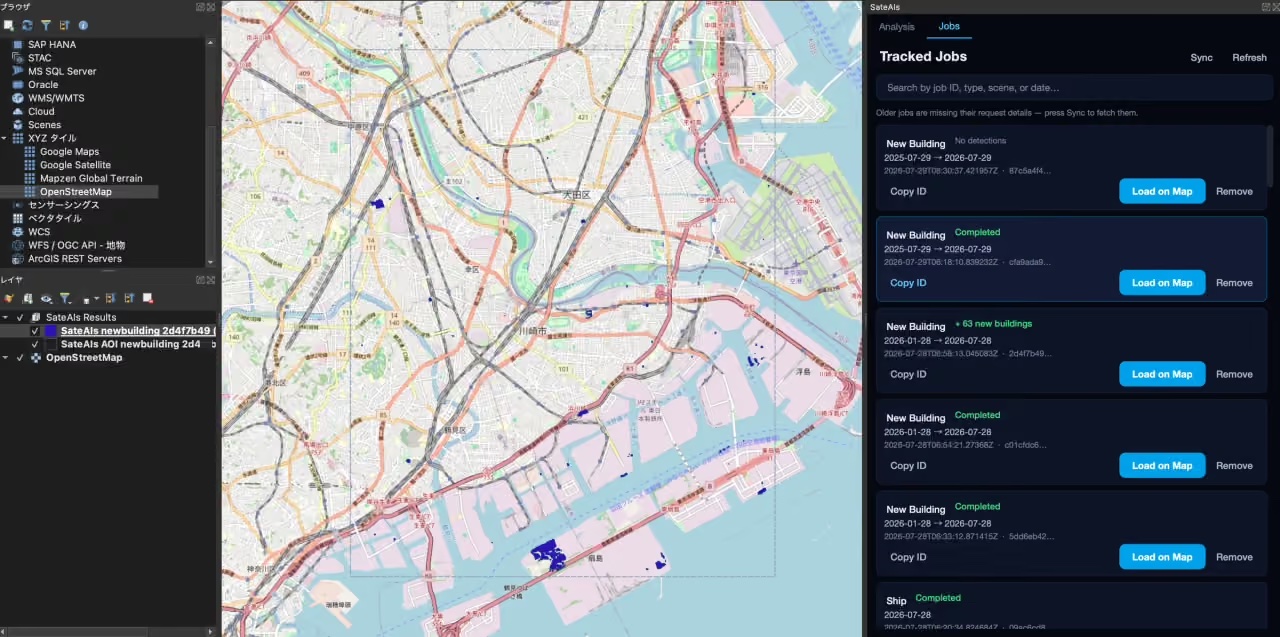 Screen capture of SateAIs analytics results in QGIS (Left: Result layer, Center: Polygon display of detection results, Right: Progress tracking in the Jobs tab). Background map © OpenStreetMap contributors
■ Key Capabilities of “SateAIs™ API for QGIS”
- Execute analyses simply by specifying a select area on the map — Choose the analysis type from the dedicated panel added to QGIS, and submit jobs simply by dragging a box over the map area.
- Results are automatically loaded as GIS layers — Analysis results are automatically added to a dedicated group as vector layers color-coded by detection type, with the view zooming directly to the detected features. Overlaying them with existing GIS data for further analysis is also supported.
- Continue working in QGIS while tasks process in the background — Analyses run asynchronously, and the job list is retained even if QGIS is restarted. Jobs submitted via the console or CLI can also be synced and centrally managed directly within QGIS.
How to Use
- Install the Plugin — Search for “SateAIs™” in the QGIS plugin manager and install it.
- Register Your API Key — Register an account and issue an API key in the SateAIs™ API Console, then enter it into the plugin’s settings.
- Specify an Area and Run — Specify an area on the map to run the analysis, and once complete, click “Load on Map” to load the results as a layer.
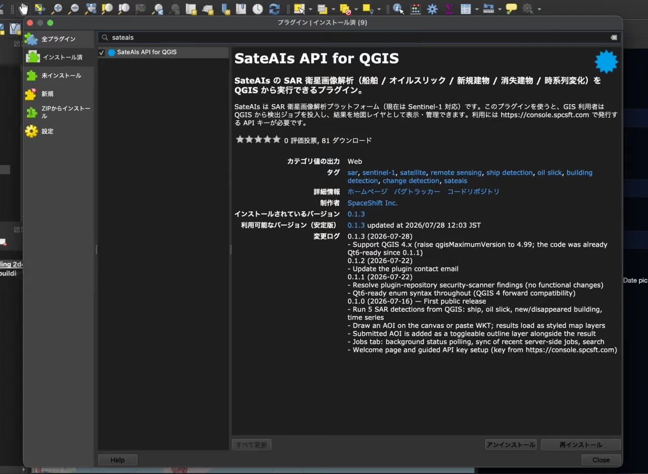 “SateAIs™” searched in the QGIS Plugin Manager
■ Supported Analyses
You can select and run the same analysis menus available in the SateAIs™ API directly from QGIS (Target satellite: Sentinel-1).
| Analysis AI | Description |
|---|---|
| Ship Detection AI | Detects the location and size of ships from SAR images. |
| Oil Slick Detection AI | Detects spilled oil on the sea surface. |
| Building Detection AI (New Construction) | Detects newly built structures within a specified period. |
| Building Detection AI (Demolition) | Detects structures that have been demolished within a specified period. |
| Time-Series Change Detection AI | Detects changes on the earth’s surface over a given period. |
Note: Supported analyses are subject to addition or change in future updates. For the latest status, please check the official QGIS plugin page or the GitHub repository.
■ Delivery Format
Compatible with QGIS 3.34 or later and 4.x, the plugin runs entirely on the Python environment bundled with QGIS, requiring no additional library installations. The source code is available as open source under the MIT license on GitHub. Because the SateAIs™ API is currently available free of charge as a beta version, you can try it out immediately by issuing an API key in the console.
Note: As the SateAIs™ API is currently in beta, features and pricing are subject to change without notice. SLAs (Service Level Agreements) do not apply.
■ Future Outlook
Space Shift will continue to expand the SateAIs™ API as a core delivery channel for satellite data analytics. By broadening support for additional GIS software, expanding compatible satellites, and adding new analysis menus, we will accelerate our efforts to create an environment where anyone can easily utilize satellite data analytics in their everyday work, regardless of industry or job role.
■ SateAIs™
https://sateais.com/ (Japanese only)
■ SateAIs™ API for QGIS
https://sateais.com/delivery-api-gis
■ Official QGIS Plugin Page
https://plugins.qgis.org/plugins/sateais_qgis/
■ GitHub
https://github.com/spaceshiftinc/sateais-qgis
For past press releases, please refer to the following:
Launch of Official SDKs and CLI for “SateAIs™ API”:
https://www.spcsft.com/en/news-en/5097/
SateAIs™ API : Now in Beta Launch :
https://www.spcsft.com/en/news-en/5008/
■ About SateAIs™
SateAIs™ is a specialized analytics brand that systematizes Space Shift’s proprietary satellite data analysis algorithms by application and delivery format, under the core concept "Empowering the Front Lines with Satellite and AI Analytics." Historically, satellite data analysis has required highly specialized knowledge, posing a significant barrier to entry. By organizing these capabilities into easy-to-select AI packages tailored to specific objectives, SateAIs provides an environment where a wide range of users—including local governments, corporations, and research institutions—can seamlessly apply satellite intelligence to resolve their daily operational challenges.
■ For inquiries regarding this post
Space Shift Inc. (Attn: Takeuchi, Mashima)
Inquiry Form: https://share.hsforms.com/1-fFRnQR2QwW3c-zOTCAanQ5m0z8
Email: pr@spcsft.com