[Press Release] Space Shift and WHERE Begin Full-Scale Collaboration Using “Site Selection AI”
– Building on use in the renewable energy sector and user feedback, the companies aim to expand into real estate and a wide range of other applications –
Space Shift, Inc. and WHERE Inc. have spent about six months demonstrating site searches, mainly in the renewable energy sector. Building on this work, the two companies will now fully advance their collaboration using “Site Selection AI,” a solution in SateAIs 都 -City-, a series of Space Shift’s satellite × AI analytics brand SateAIs™.
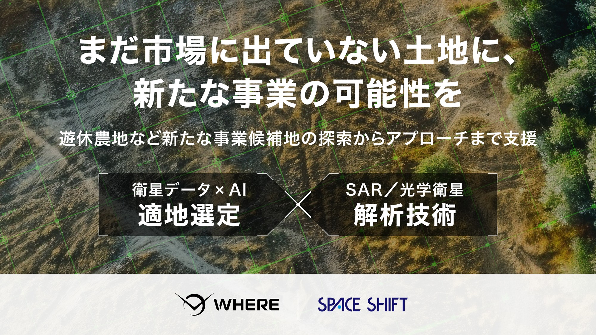
In this collaboration, the companies combine Space Shift’s AI analysis technology using SAR and optical satellite data with WHERE’s site selection technology based on satellite data × AI to identify land that may be unused, such as idle farmland. Using WHERE’s real estate information, including road access, hazards, legal regulations, and land registry data, they then narrow down candidate sites and provide end-to-end support, from checking land and owner information to approaching landowners. Going forward, the companies aim to expand beyond renewable energy into real estate development and other applications.
■ Background
In the development of renewable energy projects and construction, real estate, and logistics-related businesses, finding land that meets project requirements takes considerable time and effort. Staff must check parcels one by one on maps and aerial photographs, and many companies cannot assign staff dedicated to site searches.
Unused land, such as farmland no longer under cultivation, is drawing attention as a source of candidate sites. While it is difficult to get owners of farmland still under cultivation to consider selling or converting it, unused land remains a management burden for its owners and can prompt them to think about how to use it. However, such land rarely appears in general property listings.
This challenge has been difficult to solve with either satellite data or real estate information alone. Satellite data can be used to estimate cultivation status but cannot determine whether land can be developed. Real estate information alone, on the other hand, may not fully capture actual cultivation status. By combining their strengths, the two companies have been demonstrating, mainly in the renewable energy sector, a system for finding “land that is unused and meets project requirements” and connecting it to outreach to landowners.
■ Overview of the Collaboration
| Space Shift | WHERE | |
|---|---|---|
| Role | Estimating and evaluating land use status using SAR and optical satellite data × AI | Site selection using satellite data × AI, narrowing down candidate sites based on real estate information, and support for approaching landowners |
| Main activities | Uses Site Selection AI to analyze SAR and optical satellite data, estimate cultivation status and other conditions over wide areas, and evaluate the likelihood of idle farmland and other unused land | Selects suitable sites based on satellite data × AI and project requirements, narrows down candidates considering area, farmland classification, road access, hazard information, distance to substations, and other factors, and supports the process from checking land and owner information to approaching landowners |
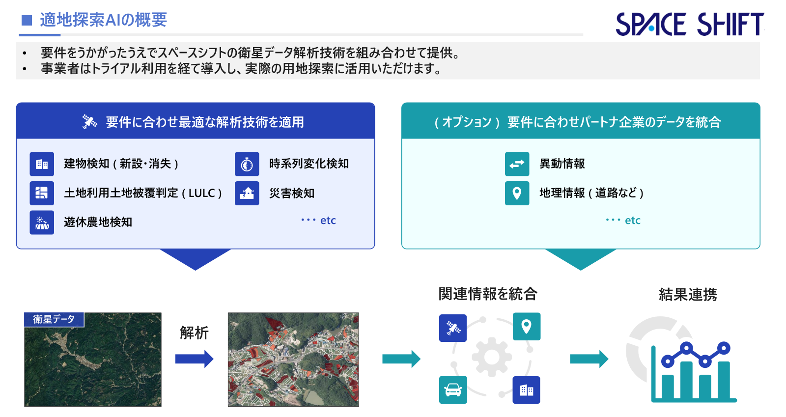
Figure 1: Overview of Site Selection AI (Japanese)
About Site Selection AI
Site Selection AI analyzes land conditions over wide areas using satellite data and AI to identify candidate sites that match a business’s project. It makes it easier to understand, before visiting a site, which land may be unused, such as idle farmland and grassland. It can support site searches for a range of uses, including renewable energy facilities, material storage yards, and parking lots.
For details (Japanese only): https://sateais.com/ai-site-selection
■ Expected Applications
In addition to renewable energy projects such as ground-mounted solar power, agrivoltaics, and grid-scale battery storage, the collaboration targets construction, real estate, and logistics-related businesses, including material storage and stock yards, apartments, parking lots, warehouses, and logistics sites. By connecting candidate site searches with owner information checks and outreach, the companies will support land acquisition for a wide range of businesses.
■ Benefits for Businesses
1. Reduce the effort required for site searches
Satellite analysis and real estate information make it possible to narrow down the pool of candidate sites before site surveys and sales activities. This reduces the work of checking parcels one by one, freeing up time for site visits, negotiations with landowners, and other work closer to closing deals.
2. Approach land that rarely appears in general property listings
Businesses can identify land that is not on the market and may be unused as candidate sites, confirm the owners, and approach them directly.
3. Create opportunities to start conversations with landowners
Unused land is also land that remains a management burden for its owners. This can serve as an entry point when proposing ways to use the land.
4. Provided to match target areas and the number of sites needed
Target areas, development conditions, and the number of candidate sites needed can be set according to each business’s plans. If there are not enough candidate sites in the target area, the search can be expanded to neighboring areas. Delivery begins about two to three weeks after the initial consultation (varies by scale).
■ About Six Months of Demonstrations and User Feedback
For about six months, the two companies have been demonstrating site searches using satellite data and AI, mainly in the renewable energy sector, including the development of solar power plants and grid-scale battery storage facilities. They combined Space Shift’s evaluation of the likelihood of idle farmland and other unused land with WHERE’s site selection using satellite data × AI and narrowing down based on real estate information and project requirements, and then approached the owners of candidate sites. As a result, the work generated responses from candidate site owners and led to new business discussions. These results suggest that even land not listed in general property listings can be considered as business sites through contact with owners.
* AI results are estimates based on satellite data analysis and are not official administrative determinations. Accuracy may vary depending on the region and timing.
* Identification as idle farmland does not mean that converting the farmland to other uses will be permitted. Actual development requires confirmation based on farmland classification and applicable laws and regulations.
About WHERE Inc.
WHERE is a JAXA-originated startup with the mission of “expanding the sphere of human activity.” Its founder, Akutsu, has started and managed eight real estate-related companies. Taking on a further challenge, he conducted research on space technology at the Graduate University for Advanced Studies, SOKENDAI, located within JAXA’s Institute of Space and Astronautical Science, and developed “WHERE,” a real estate AI tool that connects users with landowners. The company is now expanding partnerships with a wide range of industries in both the public and private sectors.
Company name: WHERE Inc.
Head office: Gate Cross HONGO 7F, 4-1-16 Yushima, Bunkyo-ku, Tokyo, Japan
Representative: Takeo Akutsu, CEO
Established: February 22, 2022
Business: Development and sales of “WHERE,” a real estate AI tool that connects users with landowners, and manufacture of space exploration probes
URL: https://pntwhere.com/en/
About Space Shift, Inc.
Space Shift visualizes changes and risks on the ground using satellite data and AI analysis. The company develops technology to analyze SAR and optical satellite data with AI and provides analysis AI for urban areas, disaster prevention, agriculture, the environment, maritime, and other fields through SateAIs, its satellite data × AI analytics product brand. Space Shift also runs SateBiz, a business co-creation program that combines satellite data with ground data held by companies, and works with companies across industries to create new services and businesses using satellite data.
Company name: Space Shift, Inc.
Head office: Otemachi Building 6F, 1-6-1 Otemachi, Chiyoda-ku, Tokyo, Japan
Representative: Naruo Kanemoto, CEO
Established: December 2009
Business: Satellite data analysis system development, satellite data analysis services, and research and consulting for space-related businesses
URL: https://www.spcsft.com/en/
Inquiries regarding this release
Space Shift, Inc. (Contact: Tada, Homma, Mashima)
Email: pr@spcsft.com
WHERE Inc. (Contact: Uchiyama)
Email: pr@pntwhere.com