[Press Release] Space Shift Launches “Site Selection AI,” a New Solution under SateAIs 都 -City-
– Using satellite data and AI to streamline the search for land that fits your project –
Space Shift has launched “Site Selection AI,” a new solution under SateAIs 都 -City-, the urban sub-brand of its satellite × AI analytics brand SateAIs™.
Site Selection AI analyzes land conditions over wide areas using satellite data and AI to identify candidate sites that match a business’s project. It helps users understand, before visiting a site, which land may be unused, such as idle farmland and grassland. It can support site searches for a range of uses, including renewable energy facilities, material storage yards, and parking lots.
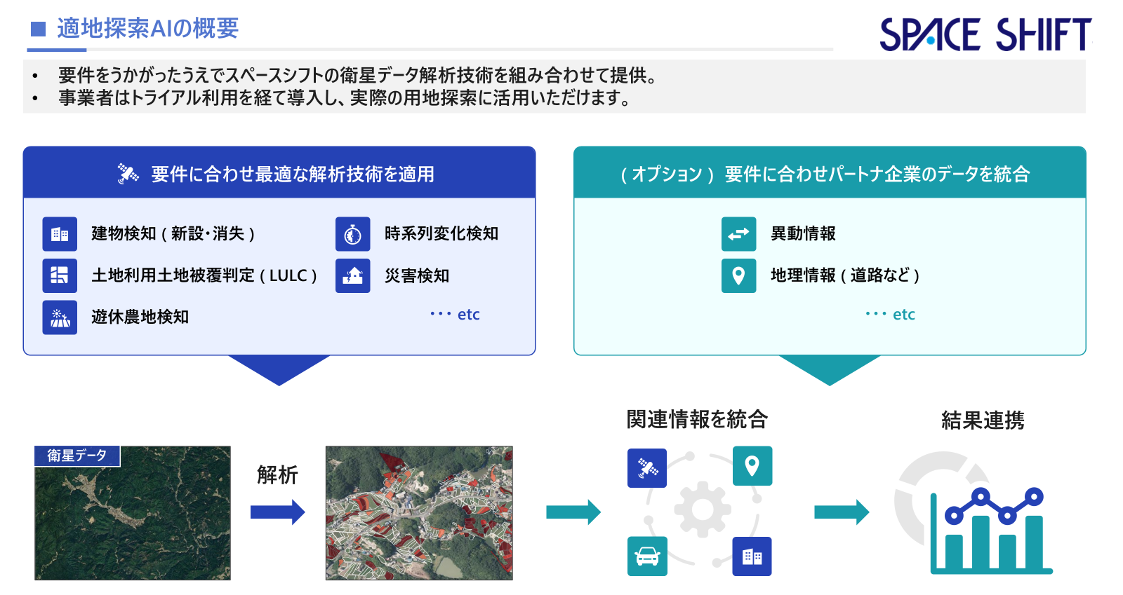
Figure 1: Overview of Site Selection AI (Japanese)
■ Background
In renewable energy, real estate, and other development projects, finding land that meets project requirements takes considerable time and effort. Checking parcels one by one on maps and aerial photographs often relies on staff experience and intuition, which can lead to oversights and inconsistent judgments.
Unused land, such as farmland no longer under cultivation, is drawing attention as a source of candidate sites. Such land rarely appears in general property listings, and it often remains a management burden for its owners. However, identifying it manually across large areas is not easy.
■ What Site Selection AI Can Do
1. Find land that may be unused across wide areas
Site Selection AI analyzes the entire target area using satellite data and AI to identify land that may be unused, such as idle farmland and grassland. Users can understand land conditions that are hard to see in aerial photographs alone before visiting the site (Figure 2).
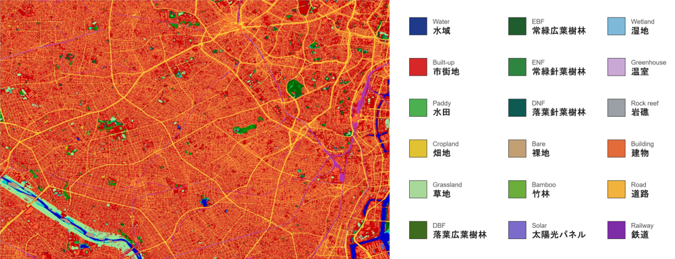
Figure 2: Examples of land cover classes identified from satellite data
Source: https://www.eorc.jaxa.jp/ALOS/jp/dataset/lulc_j.htm (Japanese)
Source: Guidelines on Methods for Calculating the Green Coverage Ratio (Park, Green Space and Landscape Division, Urban Environment Division, City Bureau, Ministry of Land, Infrastructure, Transport and Tourism) (Japanese)
2. Narrow down candidates based on project requirements
It narrows down candidate sites likely to fit each project, based on that project’s requirements.
3. Evaluate on a consistent basis to reduce variation in judgment
Because the entire target area is evaluated at once with the same AI model and criteria, variation in judgment between staff members is reduced.
4. Reduce the effort of site searches and speed them up
Narrowing down candidates before site surveys and sales activities reduces the work of checking parcels one by one, freeing up time for site visits, negotiations, and other work closer to closing deals.
■ How It Is Provided
After understanding each business’s requirements, Space Shift provides Site Selection AI by combining its satellite data analysis technologies. Businesses can adopt it after a trial and use it in their actual site searches.
* AI analysis results are estimates based on satellite data analysis and are not official administrative determinations. Accuracy may vary depending on the region, timing, satellite image resolution, and other factors.
* Identification as idle farmland does not mean that converting the farmland to other uses will be permitted. Actual development requires confirmation based on farmland classification and applicable laws and regulations.
■ Site Selection AI
For details, please visit (Japanese only):
https://sateais.com/ai-site-selection
Inquiries regarding this release
Space Shift, Inc. (Contact: Tada, Takeuchi, Homma, Mashima)
Email: pr@spcsft.com