Automatically detecting newly constructed buildings in urban areas can help understand urban trends and the status of areas around infrastructure facilities.
Automated detection of new buildings by dedicated AI algorithm
An AI algorithm specifically developed by Space Shift uses two satellite images taken at different occasions to automatically detect only newly built structures. By using color images taken by optical satellite together with the SAR satellite data, a highly accurate time series change can be captured.
The technology of Space Shift is provided on a satellite data platform operated by our business partner UP42 (headquartered in Berlin, Germany) and is already made available to the users around the world.
Note that Space Shift is the first company to provide the SAR satellite analysis technology on UP42.
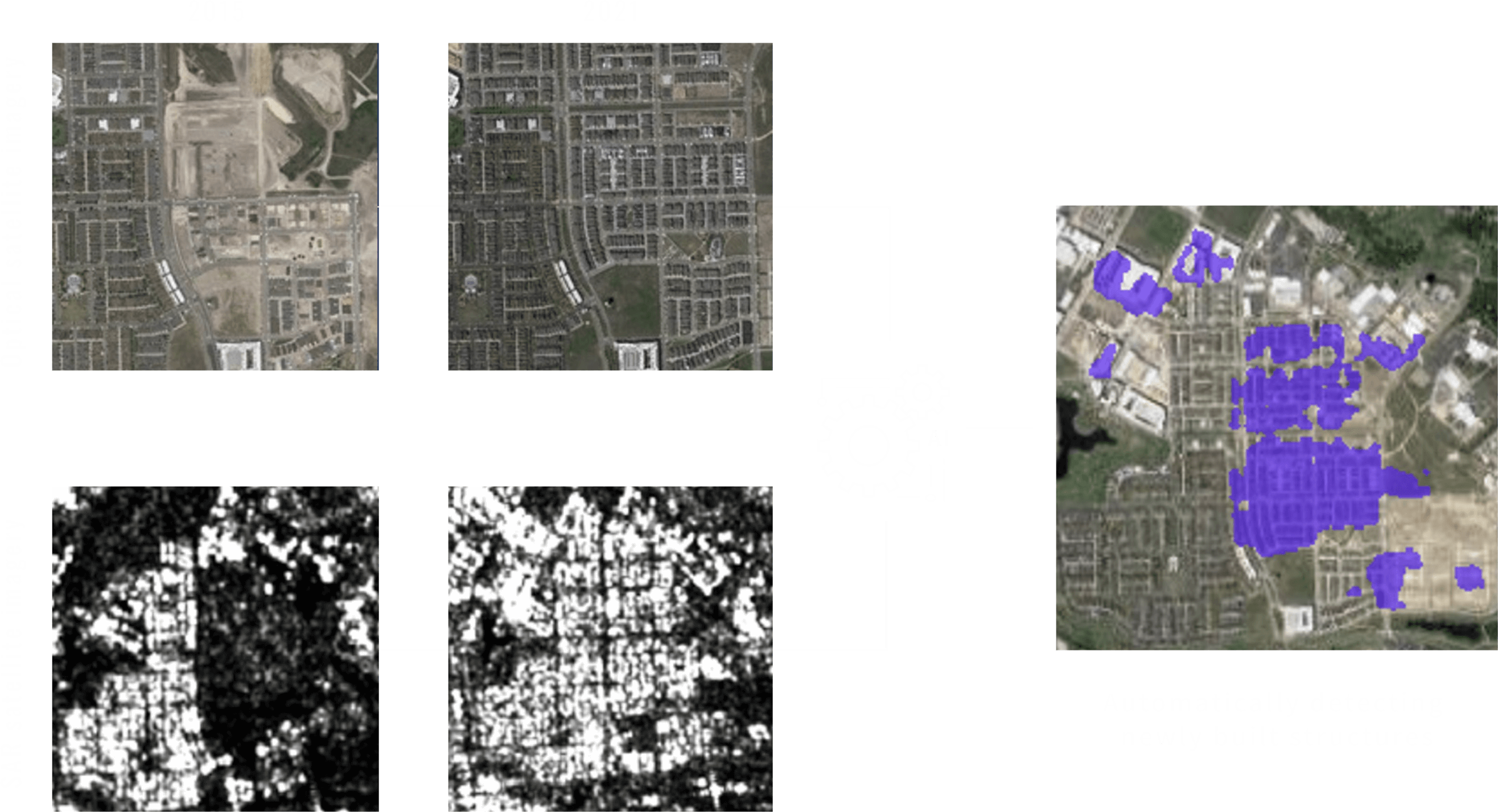
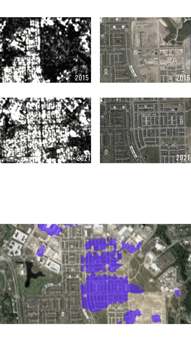
Information on new buildings in urban areas can help determine the changing trend in the city area, and can also be used in urban planning and map data updates.

Urban
developers
By recognizing newly constructed buildings, understand and monitor the environmental trends at the planned construction site or the environment surrounding your own infrastructure.

Construction
companies
By knowing the situation of new building development in urban areas, assess the urban trend and use the information in construction planning.
Real estate
companies
Knowing related Technologies